Find Your Wild.
WildPoints helps mountain bikers, gravel riders, city cyclists, bikepackers, hikers, backpackers, campers, bushcrafters, fishers, climbers, and outdoor travellers find water, food, toilets, shelter, fuel, repairs, medical help, GPX routes, weather, hazards, and precise meeting points, even when the network drops.
100%
Offline
18
Hazard Layers
Share
Deep Links
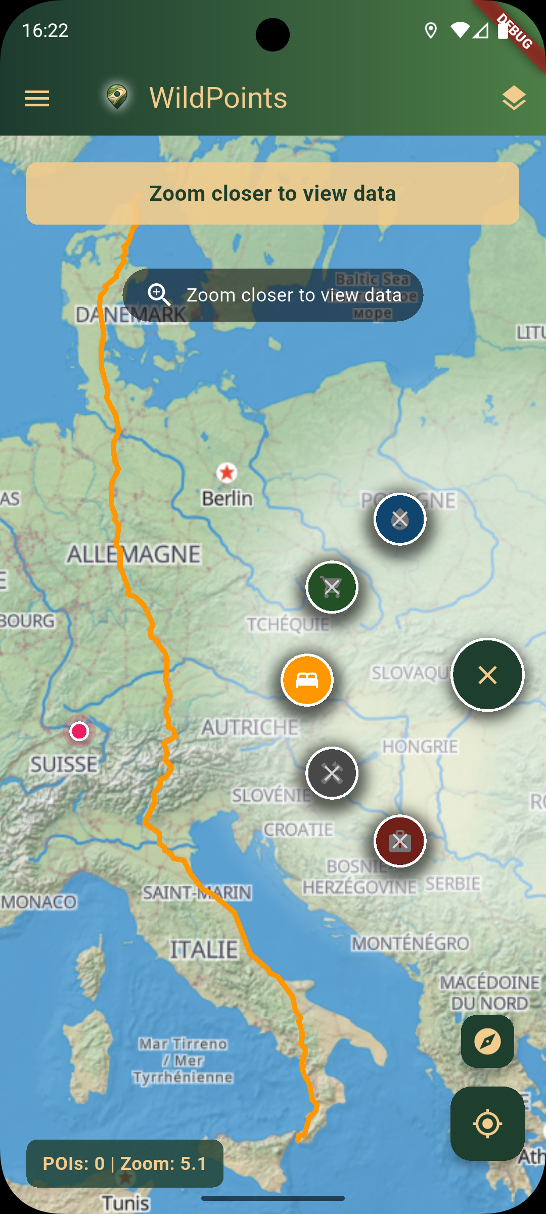
One Offline Map For Every Route
WildPoints turns OpenStreetMap Points of Interest (POIs), GPX tracks, weather, hazard layers, favourites, and deep links into practical answers for different outdoor plans, from weekday rides to remote camps.
Mountain Bikers
Find water, repair points, emergency help, storm context, and the fastest way back to a GPX line after a wrong trail turn.
City Cyclists
Use POIs for toilets, shops, cafes, repair stations, pharmacies, and exact meet-up links without digging through separate apps.
Gravel Riders
Plan long mixed-surface days with offline GPX tracks, food stops, fountains, fuel, weather, and hazard layers on one map.
Bikepackers
Keep resupply, campsites, lodging, water, repair, fuel, and shared coordinates available when the next valley has no signal.
Hikers & Backpackers
Navigate offline, check weather and hazards, locate springs, shelters, huts, toilets, medical help, and share precise trail positions.
Campers & Bushcrafters
Find flat sleeping options, water, fire or BBQ spots where mapped, nearby resupply, warnings, and safe exits from remote areas.
Fishers
Reach access points, parking, toilets, water, shops, weather checks, and shared coordinates for meeting friends at the right bank.
Climbers
Use offline maps for crag approaches, GPX lines, parking, water, weather shifts, medical help, and meet-up links for partners.
Overlanders & Van Travellers
Find fuel, water, toilets, food, campsites, hazards, and share exact spots while moving between towns and remote roads.
Everything You Need Outside
WildPoints combines offline navigation, practical POIs, weather snapshots, hazard overlays, GPX tracks, favourites, and shareable deep links for real outdoor decisions.
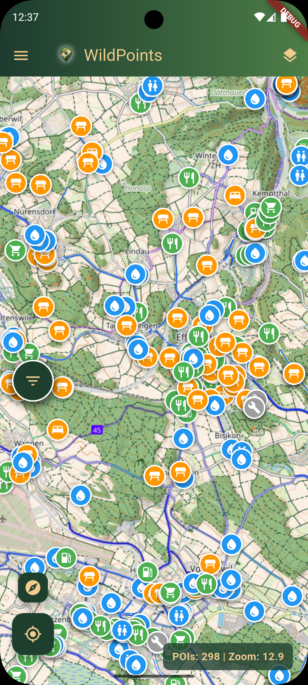
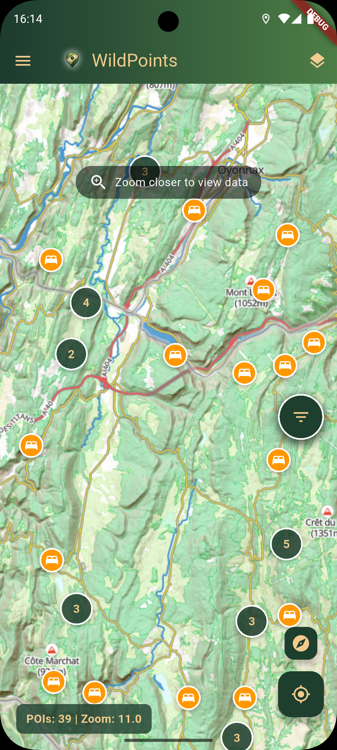
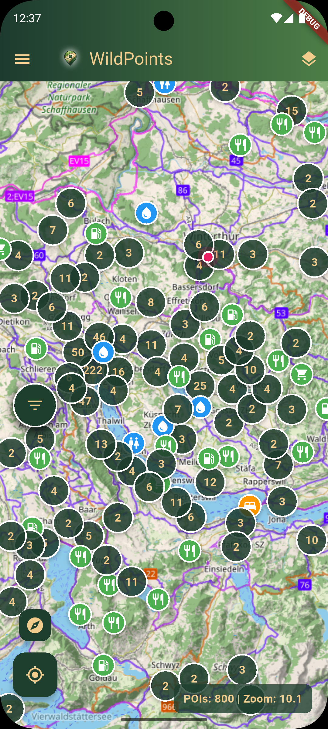
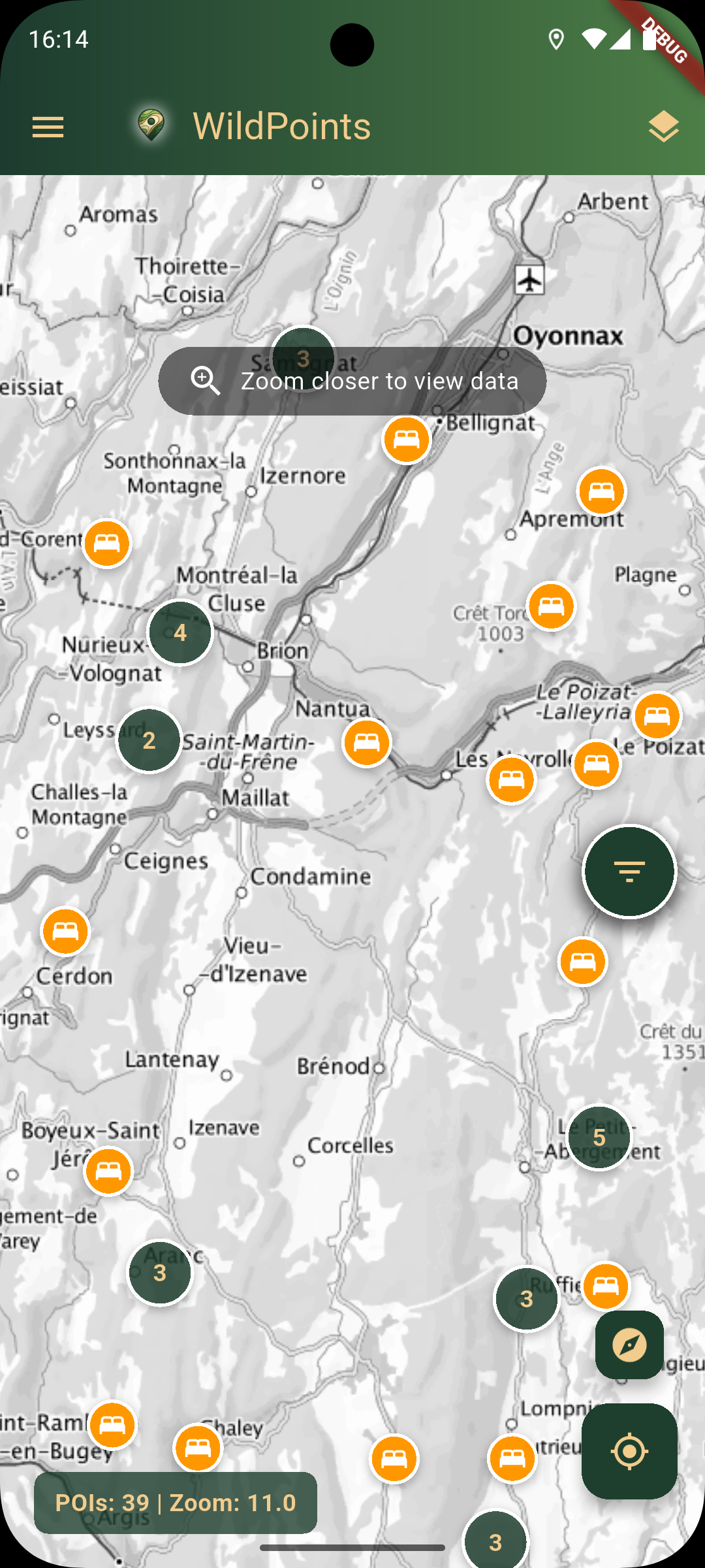
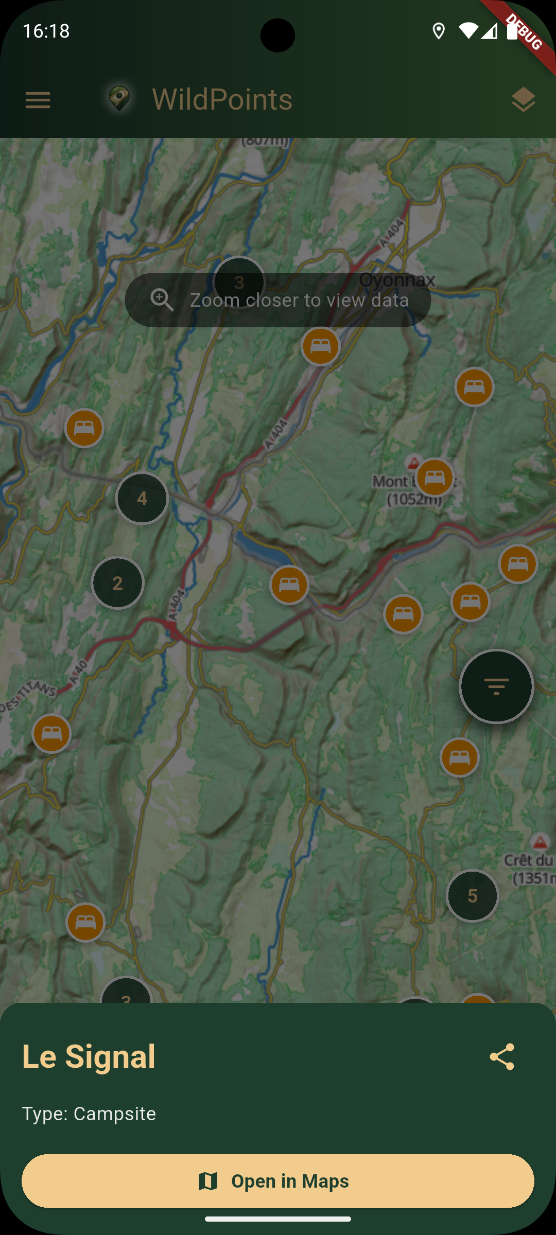
Explore all hazard overlays🗺 Interactive Outdoor Map
- Fast OpenStreetMap powered
- Multiple online and offline layers
- Favorites and quick recenter workflows
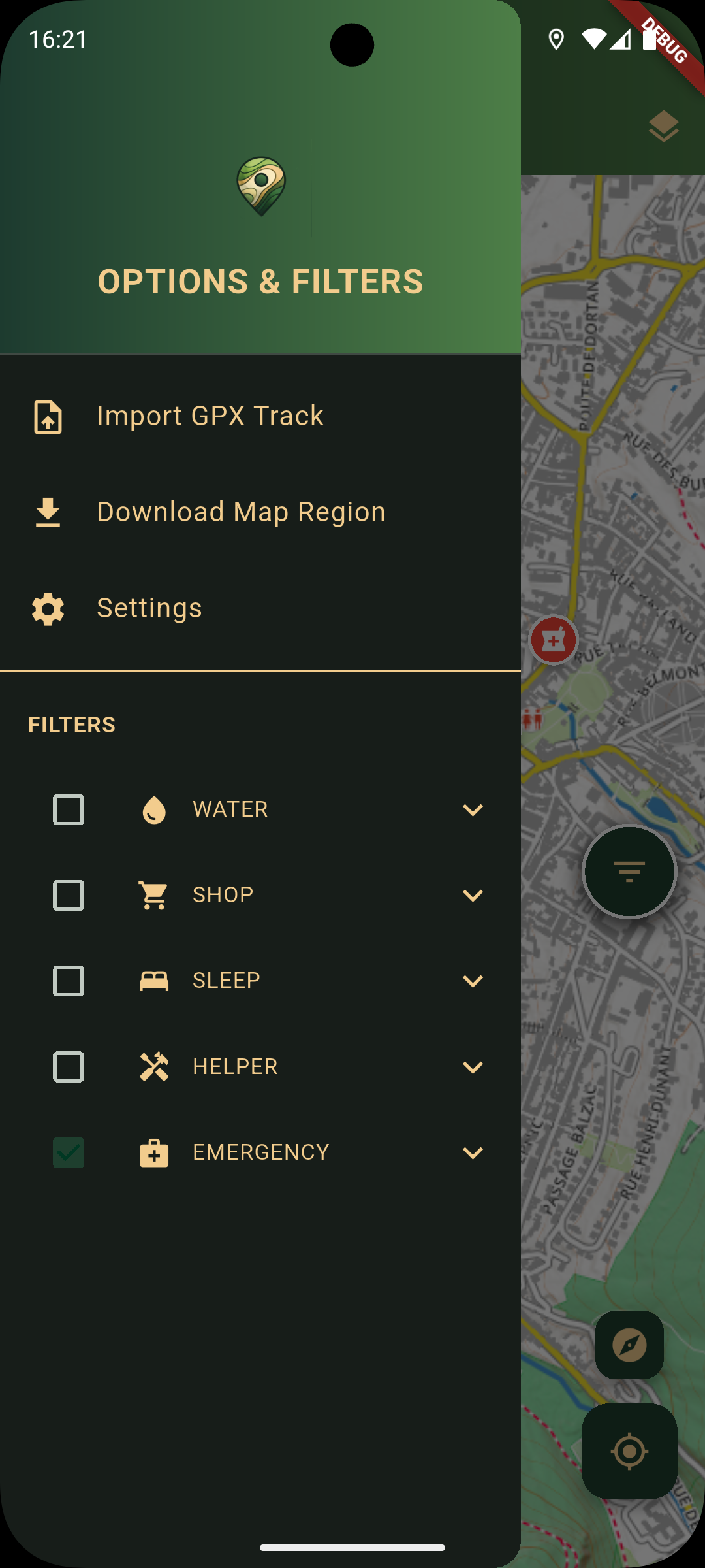
🔍 Smart POI Filtering + Radial UI
Fast category toggles in drawer and one-handed radial menu:
🌦 Weather & Hazard Layers
- Open-Meteo weather snapshots
- Storm, wildfire, AQI, heat/UV and more
- Country-aware warning feeds where available
🧭 GPX + Offline Maps
- Import routes
- Custom colors
- Offline region downloads
🔗 Deep Links & Sharing
- Share POIs and custom locations
- Open via app links or web links
- Launch external navigation apps
Essential POIs + Safety
Comprehensive OpenStreetMap POIs for cycling, hiking, camping, fishing, climbing, road trips, and emergency planning.
See real-world scenarios💧 Water Sources
- • Drinking fountains
- • Wells
- • Springs
🛒 Supplies
- • Shops & kiosks
- • Gas stations
- • Restaurants
- • Bike shops
🏕 Shelter
- • Campsites
- • Mountain huts
- • Shelters
- • Remote lodging
🛠 Helpers
- • Repair stations
- • Public toilets
- • Picnic tables
🚑 Emergency
- • Hospitals
- • Pharmacies
- • Doctors
- • Defibrillators (AED)
🛡 Safety-Focused Utility
- • Weather + hazard context
- • Resupply reminders
- • Privacy and legal transparency
- • Built for remote trips
See It In Action
Ready For The Next Route?
Navigate offline, find critical POIs, and keep weather, hazard, GPX, and sharing tools close on every ride, hike, camp, climb, fishing trip, or road detour.
100% free • No account required • Offline-first by design